GPS Dog Trails
Understanding Garmin Topo Maps

Understanding Garmin Topo Maps

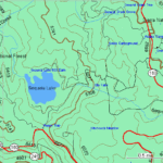
Garmin Topo Maps for seeing the landscape depiction. They can be used for campaigning and hiking purposes. These maps have different types of symbols and contour lines that represent various landscape features and elements.

Sourced through Scoop.it from: medium.com

I never really thought much about the meaning of all those curvy lines on a map until I became concerned about how steep a trail might be. The older you get, the more important a topo map becomes for a day hiker!

See on Scoop.itGPS Hiking

Five Key Principles of Training a Husky

Teach your husky that he or she can trust you to be in charge. Maintain consistent boundaries and rules. Keep him or her calm during crate training and while getting ready for a walk.

Sourced through Scoop.it from: hubpages.com

Anyone wanting to hike with their Husky dog is strongly advised to never let them off leash. I know…there are a few who argue otherwise, but is it worth the risk? The article above has some wise recommendations!

See on Scoop.itGPS Hiking

Free GPS Tools for Volunteer Emergency Responders – Gaia GPS

Gaia GPS Offline Topo Maps App – free downloads and subscriptions to volunteer emergency responders (firefighters, search and rescue and disaster relief).

Sourced through Scoop.it from: blog.gaiagps.com

I believe CERT would fall under volunteer emergency responders. Worth sharing with your local chapter…I did!

See on Scoop.itGPS Hiking