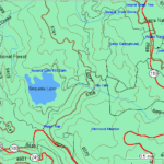
Garmin Topo Maps for seeing the landscape depiction. They can be used for campaigning and hiking purposes. These maps have different types of symbols and contour lines that represent various landscape features and elements.
Sourced from: medium.com
I never really thought much about the meaning of all those curvy lines on a map until I became concerned about how steep a trail might be. The older you get, the more important a topo map becomes for a day hiker!